Last Updated: March 5, 2024
You can open legacy MapPoint files with an alternative to MapPoint.
The last version of MapPoint was MapPoint 2013. New copies of MapPoint can no longer be downloaded for purchase.
Maptitude is one suitable desktop replacement for MapPoint. Maptitude is feature equivalent to MapPoint and supports MapPoint files. Maptitude:
- Imports MapPoint PTM files and legacy Streets & Trips ‘est’ files.
- Supports unlimited layers/geocoding/routing
- Includes radius and drive-time tools
- Includes the latest demographics
- Exports to Excel
- Creates territories
In order to import MapPoint files into Maptitude, you will need to have MapPoint 2013 installed.
You can try the steps below using your license of Maptitude Desktop, or you can request a free trial of Maptitude.
To import a MapPoint PTM file, select File>Open on Maptitude’s main menu.
Select the file type as MapPoint Map (.ptm) and then select the required PTM file.
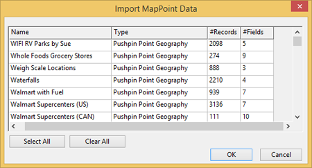
Maptitude will then analyze the map file and give you a list of the available datasets.
Each dataset is listed with a ‘type’ (e.g. Pushpin Point), plus the number of records and data fields present.
All are selected by default, but you can select just the required datasets.

You will then be asked to provide a new directory to hold the imported data.
A new directory is generally a good idea, so consider creating a sub-directory at the level of your Maptitude workspace.
Maptitude will then start the import process.

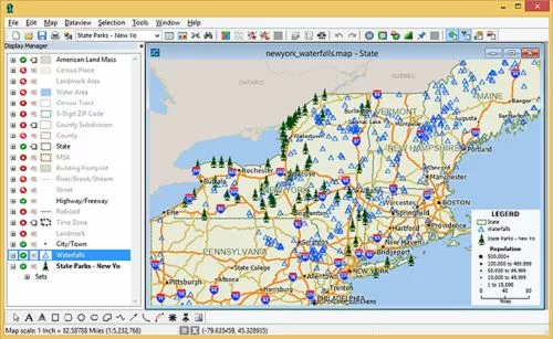
Maptitude will open a map with the layers you selected.

To import a MapPoint territory layer, please see the tutorial article on importing MapPoint territories in Maptitude.
To create a route using MapPoint files, please see the tutorial article on importing MapPoint files and creating routes in Maptitude.
For a recording of our webinar on using MapPoint files in Maptitude, please see the webinar recording on using Maptitude to replace MapPoint.
