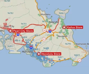
Identifying high growth areas
How to identify high growth areas
Maptitude Learning Portal articles tagged with Geographic Analysis
How to identify high growth areas
An explanation of the role of the working layer in Maptitude
How to create buffers that cover healthcare providers
An explanation on how Maptitude calculates report demographics.
How to contact the Maptitude team to request or purchase GIS consulting services.
How to use the Facility Location tool in Maptitude when you do not have any Candidate Facilities to choose from
You can visualize time series data, such as population projections, using Maptitude data visualization software. Three commons ways to visualize time series data in a Maptitude map.
You can find the central location for a set of locations or areas using Maptitude geographic analysis mapping software. Step-by-step tutorial on fidning the geographic center, mean center or weighted center for your layer.
You can import MapPoint Territory Layers with Maptitude, an alternative to MapPoint. A step-by-step tutorial on creating territories using MapPoint territory layers.
How to tag features in a layer with data from nearby features in another layer