Last Updated: March 18, 2025
You can calculate drive-time rings and travel and distance time tables for multiple points using route planning software. These tools are powerful and can provide valuable insight into your business’ operations. However, it is also important to clearly understand when to use each tool and what their differences are.
Key differences:
-
Visual Representation:
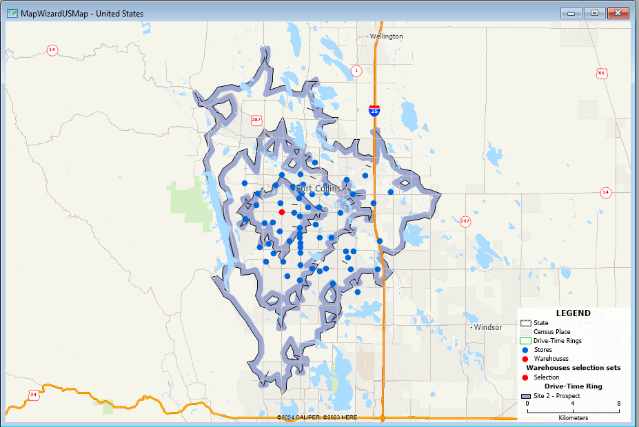
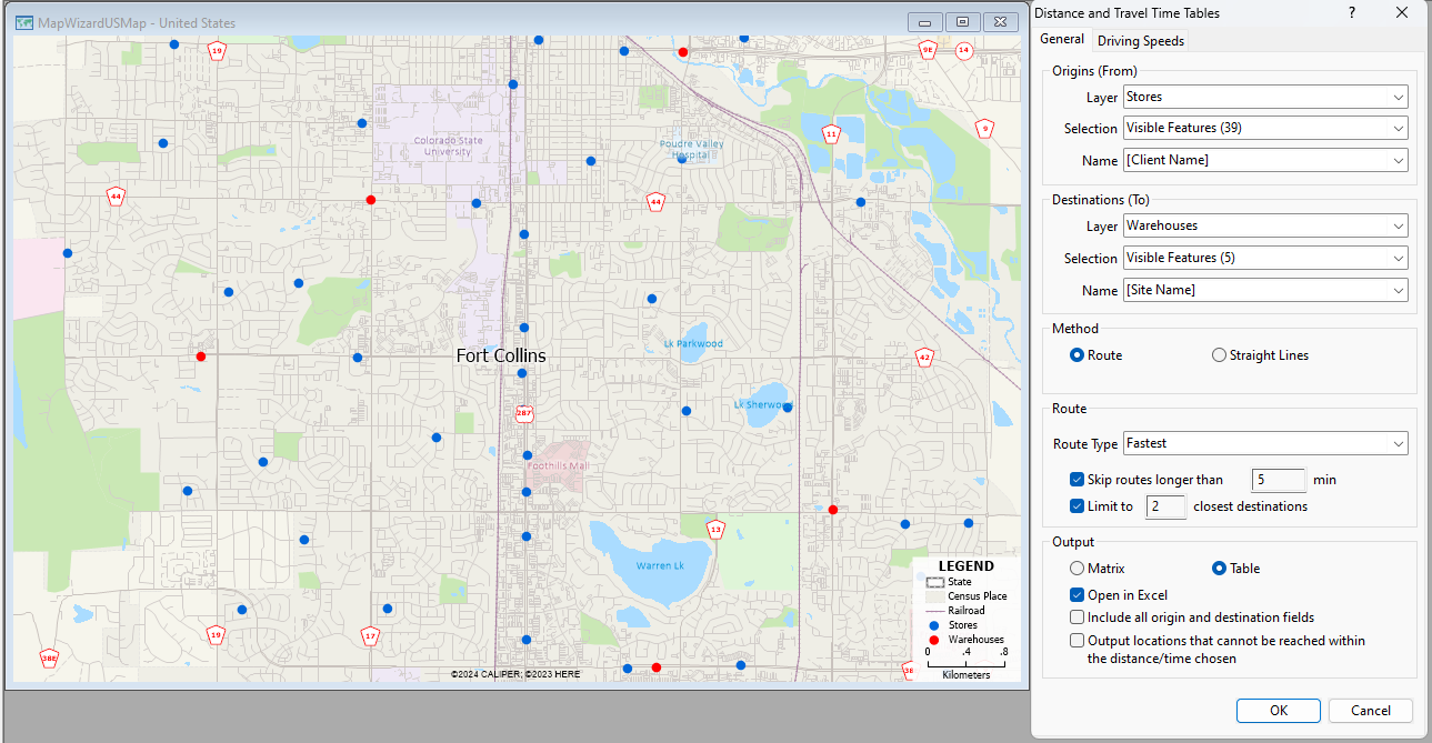
Drive-time rings provide a visual map overlay showing areas reachable within a certain time frame, while travel and distance time tables present data in a tabular format with specific driving times between locations.
-
Focus on Area vs. Specific Routes:
Drive-time rings are useful for analyzing overall accessibility to a location based on driving time, while travel and distance time tables are better for calculating precise driving times between specific points on a route.
When to use Drive-Time Rings:
- Identifying service areas for a business to understand customer reach.
- Assessing the accessibility of emergency services like fire stations.
- Planning marketing campaigns to target people within a specific driving distance.
- Analyzing potential locations for a new business considering travel time to customers.
When to use Travel and Distance Time Tables:
- Optimizing delivery routes by comparing travel times between multiple stops at once.
- Calculating the most efficient way to visit multiple locations in a day.
- Analyzing the impact of traffic on travel times between specific points.
- Comparing driving distances between different potential locations.
As a rule of thumb, you should use “drive-time rings” when you need to visually identify areas reachable within a specific driving time from a central location, like determining which neighborhoods are within a 15-minute drive of a hospital, while “travel and distance time tables” are better for comparing exact driving times between multiple origin and destination points, such as finding the quickest route between several stores for a delivery driver.
For more information on how to create drive-time rings, please see the Maptitude video on how to create drive-time rings on Maptitude.
For more information on how to create distance and travel time tables, please see the Maptitude video on how to create distance and travel time tables on Maptitude.
For more information on how to create large drive-time rings, please see the Maptitude article on how to create large drive-time rings on Maptitude.