Last Updated: March 26, 2025
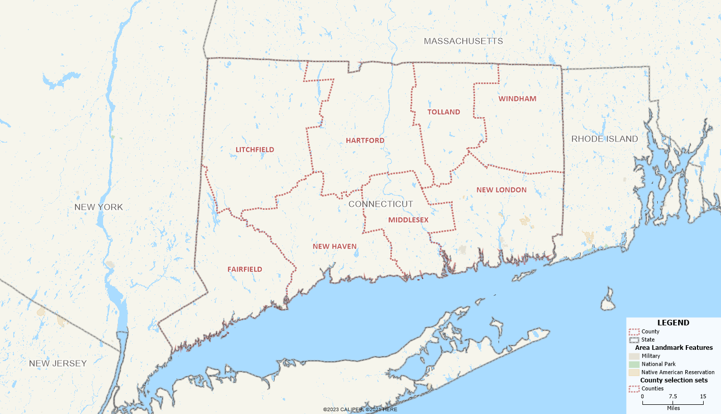
Connecticut has redefined its county structure by adopting nine planning regions, known as Councils of Governments (COGs), as county-equivalent entities for statistical and administrative purposes. This change was approved by the U.S. Census Bureau in 2022 and is set for full implementation by 2024. Historically, Connecticut was divided into eight counties, but these counties were largely non-functional for administrative purposes. With the adoption of the nine COGs, the state’s administrative and statistical geography now aligns with these planning regions. These COGs are reflected in Maptitude Mapping Software.
Mapping Councils of Government (COGs) in Maptitude
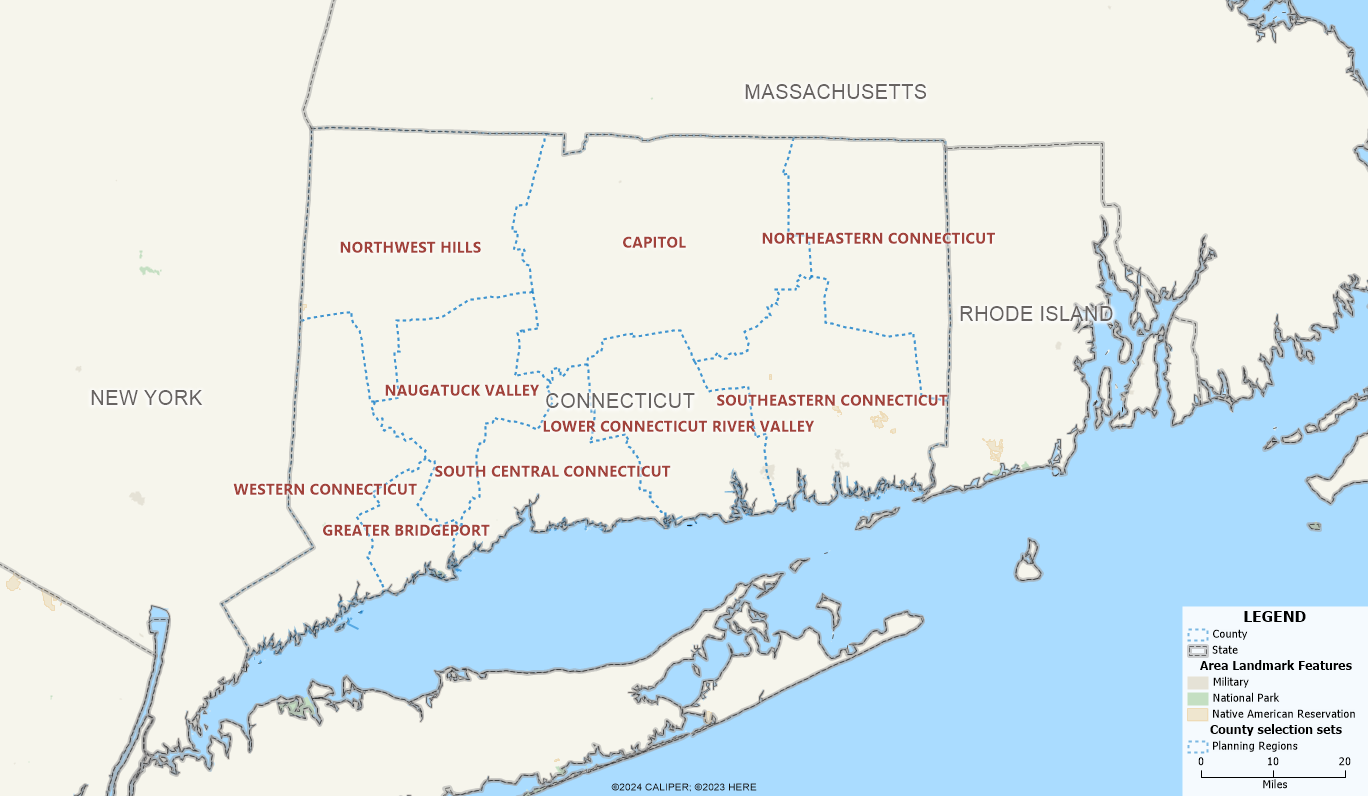
Maptitude 2024 contains COG boundaries instead of the county boundaries. To locate your data by COG, you can do the following:
- In your spreadsheet, make sure there is a column for the COG and/or ANSI code, and State.
- In the Create a Map Wizard, you can match the County ANSI field to the ANSI code column in your Excel sheet and/or you can match the County Name field to the COG column in your Excel sheet.
- You can map the COG boundaries with your data attached or you can import your data as points.
You can refer to this look-up table to see which COG your counties correspond to:
| County | ANSI Code | COG (Council of Governments) | COG ANSI Code |
| Fairfield County | 09001 | Western Connecticut COG (WestCOG)/Greater Bridgeport COG (GBCOG) | 09190/09120 |
| Hartford County | 09003 | Capitol Region COG (CRCOG) | 09110 |
| Litchfield County | 09005 | Northwest Hills COG (NHCOG) | 09160 |
| Middlesex County | 09007 | Lower Connecticut River Valley COG (RiverCOG)/Naugatuck Valley COG (NVCOG) | 09130/09140 |
| New Haven County | 09009 | South Central Regional COG (SCRCOG) | 09170 |
| New London County | 09011 | Southeastern Connecticut COG (SECCOG) | 09180 |
| Tolland County | 09013 | Capitol Region COG (CRCOG) | 09110 |
| Windham County | 09015 | Northeastern Connecticut COG (NECCOG) | 09150 |
The conversion is not one-to-one, because there are more planning regions than there were counties. The approximated conversions above are sourced from the federal register.
Mapping Block Groups in Maptitude
We have already enhanced the 2024 Block Group data by handling codes in two separate fields:
- Blockgroup: which contains the 2024 block group codes and the COG codes for Connecticut in place of county codes
- 2020 Blockgroup: which contains the 2020 block group codes from the Census Bureau and include Connecticut counties
In Maptitude 2025, you can map Connecticut block groups using both the old and new 12-digit ANSI codes.
-
Ensure your spreadsheet has a column for the block group ANSI code.
-
In the Create a Map Wizard, match the Block Group ANSI field to the appropriate column in your spreadsheet. It does not matter whether the ANSI codes in your spreadsheet are based on COGs or old county-based codes.
-
You can map block group boundaries with your data attached or import your data as points.
-
In the dataview of the mapped block groups, you will find two columns:
-
BlockGroup (current ANSI code)
-
2020 BlockGroup (corresponding 2020 ANSI code)
-
Mapping Census Tracts in Maptitude
Similar to block groups, you can map Connecticut tracts using both the old and new 10-digit tract ANSI codes.
-
Ensure your spreadsheet has a column for the tract ANSI code.
-
In the Create a Map Wizard, match the Tract ANSI field to the corresponding column in your spreadsheet. It does not matter whether your ANSI codes are based on COGs or old county-based codes.
-
You can map tract boundaries with your data attached or import your data as points.
-
In the dataview of the mapped tracts, you will find two columns:
-
Tract (current ANSI code)
-
2020 Tract (corresponding 2020 ANSI code)
-