Types of Analysis
Maptitude Online has several tools for performing geographic analysis. With Maptitude Online you can:
A buffer is an area of a specified width that surrounds one or more map features. You can create around every feature in a layer when you are creating a new map or you can create buffers around filtered features in a map.
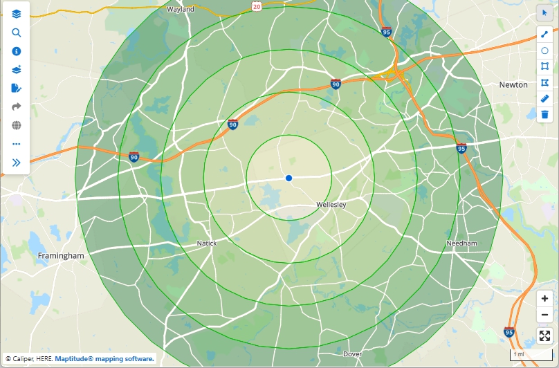
This store layer in this map has buffers around it a at 1, 2, 3, 4, and 5 mile intervals.
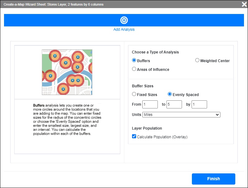
You can set buffer sizes in one of two ways:
When you build buffers around a single feature, Maptitude creates one area for each buffer you request. When you build buffers around two or more features, you have a choice of whether the buffers should be separate or joined.
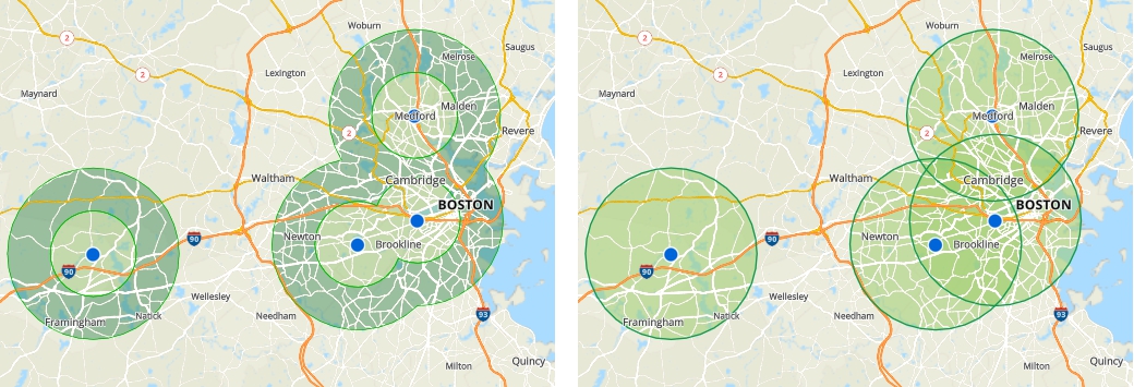
These maps show the locations of four stores. The merged buffers on the left allow you to compare the population that lives close to a store (0-2 miles) to the population that lives farther away (2-4 miles). The separate buffers on the right allow you to compare the populations around each individual store.
In addition, you can choose to have Maptitude Online calculate the population inside of the buffers that you create.
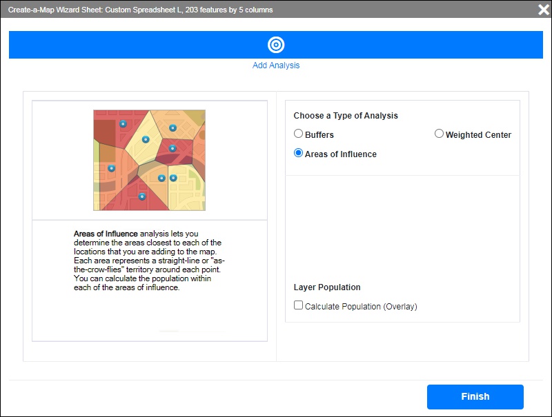
Areas of Influence are a way of visualizing catchment areas for a group of points. Areas of Influence use straight-line distances to determine proximity such that any location within an area is closer to its origin point than any of the other origin points. They are also known as Thiessen Polygons or a Voronoi Diagram.
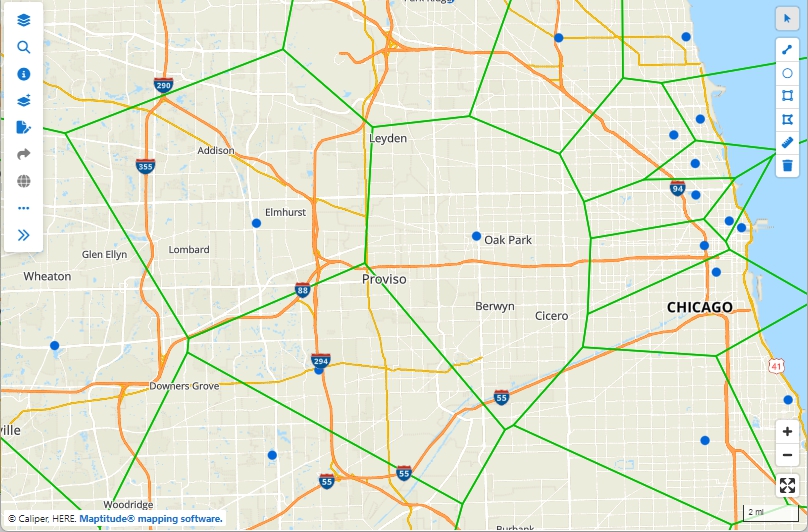
Areas of influence in this map show the areas that are closest to each store.
You can choose to have Maptitude Online calculate the population inside of the areas that you create.
Weighted center determines from a set of points, such as customers, a circular service area that encompasses all of the points and its center. Optionally, the center can be placed at the average of the coordinates or weighted by any field in your point layer.
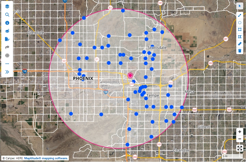
The circle encompasses all of the locations on the map and the weighted center of these locations is shown with a magenta bull's-eye.
You can choose to have Maptitude Online determine how to weight the center:
©Copyright Caliper Corporation www.caliper.com