|
January 2018 Newsletter |
|||
|
|||
Website | Contact Us | Pricing | Live Demo | Free Trial | Reviews
Sneak Preview: Maptitude 2018 Shows Results More Quickly Than Ever Before!
Update Your Linked Excel Locations, Import MapPoint Waypoints, and Access New Premium Data
Maptitude 2018 is due out in the first quarter of 2018, and we are offering you an exclusive first look at some of the new features!
Update Linked Tables
Data
linking was one of the best features of Microsoft MapPoint and has
been added to Maptitude 2018! Maptitude 2018 allows you to
update your map with any changes made to your data source.
For example, if you have added/deleted/changed customer records in
an Excel spreadsheet, you can simply choose to update your Maptitude
map layer with the latest information and locations.
Enhanced Data Import
Maptitude 2018 imports waypoints from MapPoint and
Streets & Trips and successfully geocodes/pin-maps
even more address and postal data.
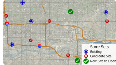
A new site selection wizard helps you identify the best locations for servicing your customers or target market.
Enhanced Results
You can create drive-time zone reports using the
labels/names of your stores and customers. And the Wizard-driven interface
guides you through adding shaded boundaries
to an existing map, such as adding sales by ZIP Code to a
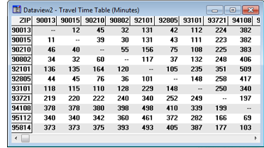
customer map. You can also create travel time or distance
tables between ZIP Codes or any other area layer.
New Premium Data
Only
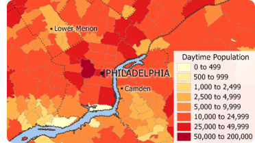
Maptitude 2018 users will have access to our completely new business-critical data. Now included for all layers from ZIP Code to State
are the growth in income and population and
daytime population counts. We will also be
updating the
free premium data for our Maptitude 2018 customers.
Maptitude comes with the latest commercial grade map data and demographic information available. Maptitude includes annually refreshed Census and business data and the most accurate streets and USPS ZIP Code boundaries. If you work for a business that relies on accurate and updated travel costs, demographics, and locations, then Maptitude 2018 is your best choice. And all for only US$395 (per upgrade).
Featured Map:
1-Year Percent Growth in Average Income by State
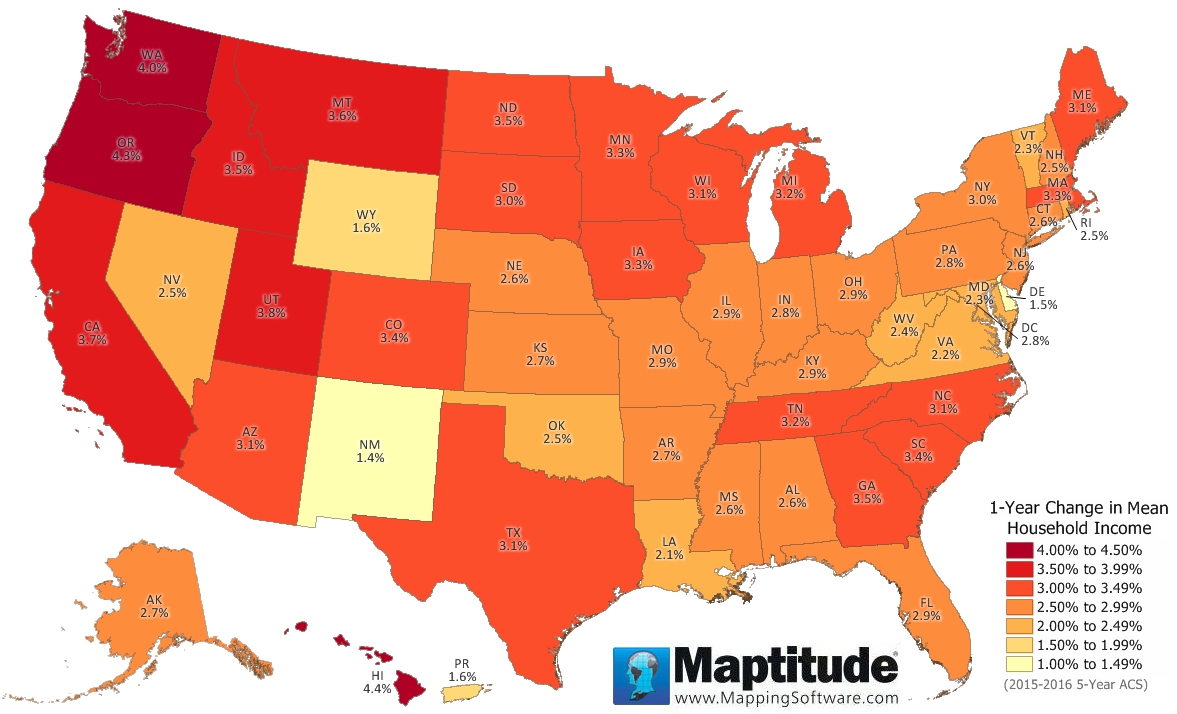
This month's featured map uses the Maptitude 2018 income growth data for the United States. This data is available for ZIP Codes, Counties, States, and many other layers. Hawaii, Oregon, and Washington top the list with over 4% growth in income.
Tech Tip:
How do I create a demographic map?
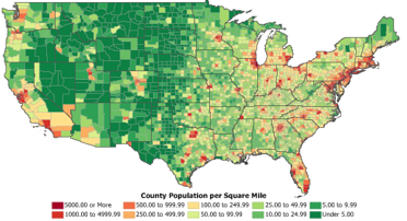
To quickly create a demographic map you can use the Demographic Map Librarian. Maptitude ships with a library of economic, social, housing, and demographic maps that you can choose from. This Tech Tip shows you how to open and synchronize two ZIP Code maps.
Tricks & Tips:
How do I permanently save the style settings for a layer
The Maptitude Layer Manager allows you to:
• Copy, Rename, and Delete layers
• Save style settings for a
layer
• Archive (create a compressed *.zip file of) a layer
When you have a layer looking exactly the way you want it to, you can permanently save the style, labels, sets, themes, and legend settings to that layer. Simply choose Tools > Editing > Layer Manager and click Save Settings.
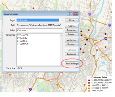
From then on, any time you add the layer to a map (by using
Map > Layers or clicking
![]() on the Standard toolbar),
it will always look the same.
on the Standard toolbar),
it will always look the same.
Learning Maptitude:
Webinars and Training Dates for Maptitude
 |
Upcoming Training: |
|
 |
2017 Webinars (Free)! |
| News | ||
|
International Mapping:
| www.caliper.com |
Copyright ©2018, Caliper Corporation. All Rights Reserved. |

