| New Free Business and Point of Interest Layers for Maptitude 2020 |
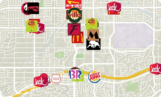
Some of the Maptitude 2020 business layers
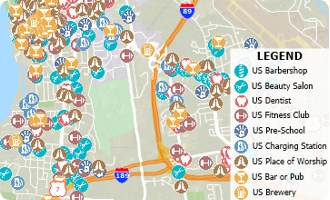
Some of the Maptitude 2020 point of interest layers |
|
Download the locations of the largest businesses and points of interest — FREE for Maptitude 2020 users!
Don't have Maptitude 2020? Purchase or upgrade Maptitude 2020 to use this premium business data.
» Business layers are for individual chains (such as Bank of America, Taco Bell, Walmart, etc.), include address and telephone number, and most display with company logos.
» Points of interest layers are grouped by category (such as hospital, medical service, auto dealerships, banks, shopping, restaurants, etc.).
Both the business and point of interest layers are updated for 2020. These layers can be added to any Maptitude 2020 map and are perfect for site location, competitive analysis, routing, and real estate reports. |
|
|
|
|

|
“We've been using Maptitude for more than 20 years. It is by far 'the best bang for the buck' in GIS software. I can't believe the amount of demographic data that comes with the product. The sophistication is incredible, but the software is relatively simple to use. We've been using Maptitude to map our CRA Assessment Areas for banks. We also use it for branch impact studies (required by regulators). When we started using drive-time rings to determine the practical service area of bank branches the regulators were really impressed.”
Len Suzio
GeoData Vision |
|
Featured Map:
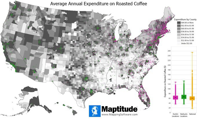
Annual Coffee Expenditure Chain Comparison
|
|
| Maptitude allows you to map locations in almost any industry such as coffee shops (quick service restaurants or QSRs). Here we map Dunkin vs Starbucks locations, against consumer expenditure on roasted coffee. Maptitude allows you to explore detailed consumer spending data (per capita) on a huge variety of goods.
» More about this map and other featured maps
|
Tech Tip:
How do I create overnight routes or routes with no fixed end time? |
|
|
When analyzing long-haul trips, an analyst often wants to model routes that go through the night or that have custom rest times. Maptitude allows you to create overnight routes or routes with no fixed end time.
» Learn How Here |
|
|
|
|
Tricks & Tips:
Creating a map with wide white streets |
|
|
Sometimes you need to see streets displayed with a different style, often as wide white lines. There are several ways to do this:
- From the Home window, choose New demographic map and click OK, then choose USA (Optimized for large scale maps) from the Overview Maps category in the Map Librarian.
- If you already have a map open, choose Map>Demographic Map Librarian, then choose USA (Optimized for large scale maps) from the Overview Maps category in the Map Librarian.
- Hide the street layer and add an image layer such as OpenStreetMaps from the Map>Imagery submenu.
|
|
|
Learning:
Training: October 6-8, 2020 • Newton MA, USA • Details | Register
Webinars: Schedule and archive
Videos: Maptitude Videos
Other free mapping and learning resources
|
|
|
| International Mapping:
 |
|
|
|


