| Upgrade to Maptitude 2020 for US$395: Last Chance! |

Limited Offer: Valid for desktop licenses older than Maptitude 2018 until June 30, 2020. Restrictions Apply.
|
|
|
|
| New Data for the UK, Ireland, Canada, Australia, Mexico, Brazil, USA, New Zealand |
| Seven 2020 Country Packages have now been released. Details for each can be found in the Maptitude 2020 New Features PDF. The United Kingdom and Ireland, Canada, Australia, Brazil, Mexico, USA, and New Zealand are now available. |
|
|
Key Features:
» Improved address matching (geocoding) and directions
» Updated streets, postal data, business and landmark locations, and cities/towns
» Updated travel times using actual traffic congestion data
» For each country a logistics tutorial file is included that lists sample clients, sites, and facilities to allow you to quickly familiarize yourself with the analytical capabilities of Maptitude
Additional Features:
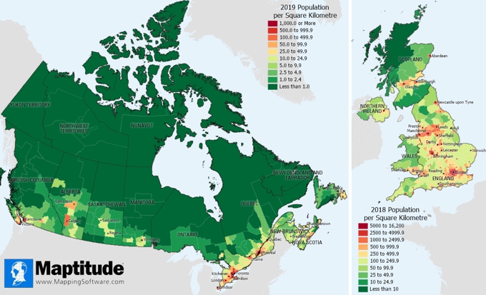
» UK: 2018 population estimates by age and gender for British Isles, County, District, Euro Region, Local Government, Middle SOA, SOA, and Ward
» Canada: 2019 Population estimates for Provinces, Census Divisions and Subdivisions; enhanced directions when routing with parking lots for the top 11 metro areas |
|
|
|
There are many more improvements in Maptitude 2020. Please contact the Maptitude Sales Team with any questions.
|

|
“We have found Maptitude to be a really useful piece of software. It allows us to quickly and easily represent various data geographically, and the ease of functionality and ability to layer data makes it really user friendly. It has, among other things, helped us develop our sector-leading delivery service and understand areas that require focus from our sales teams.”
Richard Horton
Head of Fleet Services TPPLC, Travis Perkins, Northampton UK |
|
Featured Map:
Updated Population Counts (New Maptitude 2020 Data!) |

|
»
More about this map and other featured maps
|
Tech Tip:
How can I create worldwide territories in Maptitude 2020? |
|
|
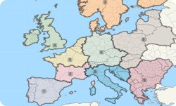
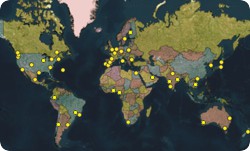
Maptitude 2020 allows you to create territories across the world, often down to sub-national administrative boundaries.
» Learn How Here
|
|
|
Tricks & Tips:
Using Maptitude 2020 for other countries |
|
|
You can use Map>New Map to geocode your locations by country, by world city/town, and by coordinate, and to create heat maps of your data by country. You can add global backgrounds via Map>Imagery.
There is also a Download Free Layers Add-In that allows you to create Country Packages for anywhere in the world using open source data, and which supports global geocoding of varying accuracy. |
|
|
Learning:
Training: June 2-4, 2020 • Virtual Classroom • Details | Register
Training: October 6-8, 2020 • Newton MA, USA • Details | Register
Webinars: Schedule and archive
Videos: Maptitude Videos
Other free mapping and learning resources
|
|
|
| International Mapping:
 |
|
|
|


