New Premium Data for Maptitude 2019!
Free Bank and Credit Union Layers for the USA, UK, and Canada
Download the locations of bank and credit union branches — FREE for Maptitude 2019 users! |
|
| Don't have Maptitude 2019? Purchase or upgrade Maptitude 2019 to use this premium business data.
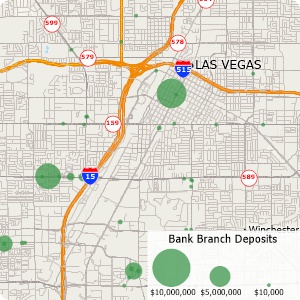
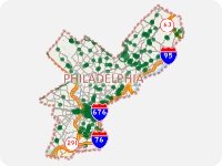
» The U.S. Bank Branches layer is based on the FDIC list of all insured institutions and locations from August 8, 2019. It includes information on the name of the branch, its unique identification number, when the branch was established, whether or not it is an institutional main office, and total deposits for that branch from 2018.
» The U.S. Credit Unions layer is based on the NCUA Credit Union Call Report Quarterly Data from March 2019. It includes information on the name of the branch, its unique identification number, branch telephone number, and whether or not it is an institutional main office.
|
|
|

|
“When we are helping financial institutions create and define geographically targeted market segments, HMDA and CRA Small Business analysis, loan trends, Competitive Analysis, market share, Business and Deposit trends - our tool of choice is Maptitude. It is one of the most
affordable and feature-packed desktop GIS software in the market. It comes bundled with all the Census and other spatial data related to the financial service industry.”
Steve Bouton
ITS - Integrated Tracking Systems |
|
|
|
The Maptitude Country Packages are all nationwide in scope, but sometimes you may want to restrict your map to show just a particular region. You can create masks that hide features outside of your area of interest. Simply use the selection tools to select the area you want to display (e.g., a state, county, or cluster of postal codes) and choose Tools>Reports>Mask to display the Create a Mask dialog box, choose the type of mask, and click OK.
» Video tutorial on making masks with Maptitude |
|
|


