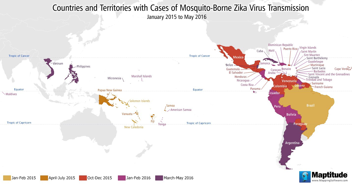
Maptitude is the best mapping software for business intelligence! Recently there has been a significant increase in the number of countries reporting mosquito-borne Zika virus transmission. This map shows the countries and territories that, according to the World Health Organization, have had cases of mosquito-borne Zika virus since January of 2015.

Map: Created with Maptitude Mapping Software by Caliper,
May
2016
Source: World Health Organization
Home | Products | Contact | Secure Store