Mapping Software and GIS Glossary
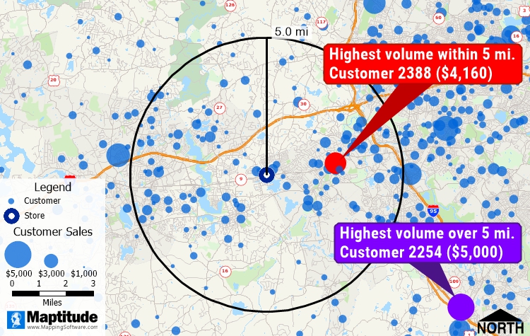
Freehand items are user-drawn graphical elements that can be added to a map or layout. Freehand items can include simple shapes, arrows, or complex drawings that provide context to geographic data.
Freehand items are commonly used for annotations, drawing items, highlighting areas of interest, or creating custom map decorations. Maptitude allows users to align, resize, style, and rotate freehand items to improve map presentations. This functionality is beneficial in marking areas of concern on planning maps, sketching proposed changes in zoning maps, and enhancing the clarity of reports and presentations.
Maptitude Mapping Software gives you all of the tools, maps, and data you need to analyze and understand how geography affects you and your business. Maptitude maps can help you better understand how geography affects you and your business.
Home | Products | Contact | Secure Store
