Mapping Software and GIS Glossary
In GIS and mapping, a feature represents a real-world object or phenomenon that is represented on a map or within a dataset. Features can include points (e.g., landmarks), lines (e.g., roads), and polygons (e.g., land parcels), each with associated attributes such as name, size, or classification.
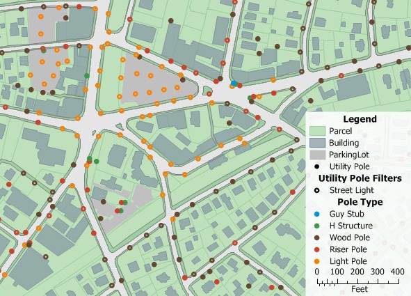
Every individual parcel, building, and utility pole is a feature that together make up this map.
Maptitude Mapping Software gives you all of the tools you need to map your data.
Learn More Free Trial Free for Students/Teachers
![]()
![]()
![]()
![]()
![]()
![]()
![]()
![]()
Home | Products | Contact | Secure Store
