Mapping Software and GIS Glossary
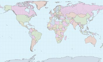
A map projection is a method for taking the curved surface of the earth and displaying it on something flat, like a computer screen or a piece of paper. Map makers have devised methods for taking points on the curved surface of the earth and "projecting" them onto a flat surface. These methods enable map makers to control the distortion that results from creating a flat map of the round earth.
Every map projection has some distortion. Equal area projections attempt to show regions that are the same size on the Earth the same size on the map but may distort the shape. Conformal projections favor the shape of features on the map but may distort the size.

What is a map projection? The Equal Area Projection on the left correctly shows the relative sizes of regions on the map. For example, Alaska is about twice the size of Texas. The Conformal Projection on the right correctly shows the shapes of areas such as Alaska and Texas. However, the sizes of areas on the map are distorted. Alaska now looks much larger than it really is.
Maptitude Mapping Software gives you all of the tools, maps, and data you need to analyze and understand how geography affects you and your business. Maptitude supports dozens of projections to suit your needs.
Learn More Free Trial Free for Students/Teachers
![]()
![]()
![]()
![]()
![]()
![]()
![]()
![]()

Home | Products | Contact | Secure Store
