Mapping Software and GIS Glossary
Field mapping refers to the process of collecting and recording spatial data directly in the field using GPS devices or other data collection tools. This data may include information about the location, attributes, and characteristics of features on the ground.
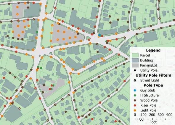
Field mapping is useful for identifying and mapping infrastructure such as utility poles
Maptitude Mapping Software gives you all of the tools you need to collect and map your data.
Learn More Free Trial Free for Students/Teachers
![]()
![]()
![]()
![]()
![]()
![]()
![]()
![]()

Home | Products | Contact | Secure Store
