Mapping Software and GIS Glossary
Geospatial analysis involves the examination and interpretation of geographic data to identify patterns, trends, and relationships within spatially referenced information. It encompasses a variety of analytical techniques, such as spatial statistics, network analysis, and suitability modeling, to derive insights from spatial data.
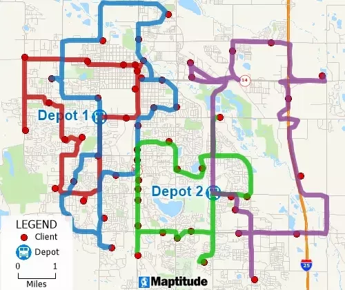
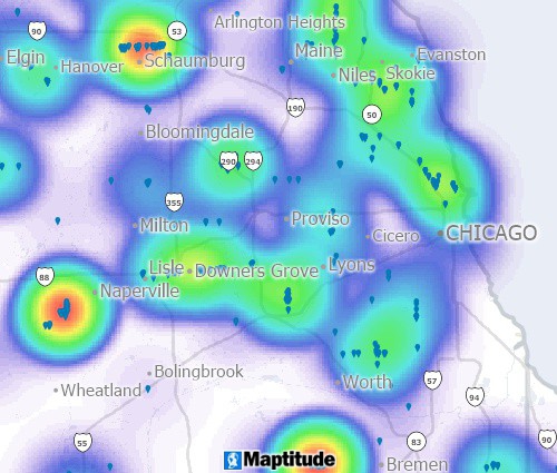
Geospatial analysis tools can solve complex routing problems and identify trends hidden in spreadsheets.
Maptitude Mapping Software gives you all of the analysis tools you need to to make better business decisions.
Learn More Free Trial Free for Students/Teachers
![]()
![]()
![]()
![]()
![]()
![]()
![]()
![]()
Home | Products | Contact | Secure Store
