Mapping Software and GIS Glossary
Land cover classification is the process of categorizing the types of surfaces and vegetation covering the Earth's land surface based on remotely sensed imagery or other spatial data. Common land cover classes include forests, croplands, urban areas, water bodies, wetlands, and barren lands.
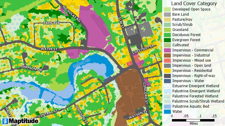
Land cover classification map
Maptitude Mapping Software gives you all of the tools, maps, and data you need to analyze and understand how geography affects you and your business. Maptitude includes tools for mapping land cover classification.
Learn More Free Trial Free for Students/Teachers
![]()
![]()
![]()
![]()
![]()
![]()
![]()
![]()
Home | Products | Contact | Secure Store
