Mapping Software and GIS Glossary
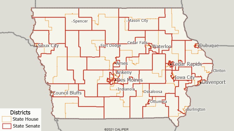
Nesting is a redistricting method of creating two or more state lower legislative chamber districts that are completely contained within the boundaries of a state upper legislative chamber district. A number of U.S. states either require or encourage the lower district boundaries to nest within the upper district boundaries.

The Iowa General Assembly consists of a 100 member House of Representatives and a 50 member senate. Two house districts nest within each senate district.
Maptitude for Redistricting is the professional tool for political redistricting. It is used by a supermajority of the state legislatures, political parties, and public interest groups.
Home | Products | Contact | Secure Store