Mapping Software and GIS Glossary
Raster data is a geographic data type where data is stored as a grid of regularly sized pixels along with attribute data. Individual pixels linked to specific coordinates, which represent a physical position in the world, make up categorical or continuous raster data at its most basic level.
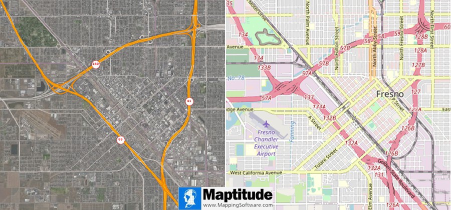
Two Maptitude maps with raster data layers. The map on the left contains a raster data layer of satellite imagery and the map on the right is made of a raster data layer of an OpenStreetMap image.
Maptitude Mapping Software gives you all of the tools, map layers, and data you need to analyze and understand how geography affects you and your business. Maptitude also supports raster data of many sorts including online satellite imagery, MrSID files, TIFF and GeoTIFF files, JPEG and JPEG2000 files, digital orthophotos, SPOTVIew satellite images, and more.
Maptitude supports various raster operations, including:
Learn More Free Trial Free for Students/Teachers
![]()
![]()
![]()
![]()
![]()
![]()
![]()
![]()
Home | Products | Contact | Secure Store
