Mapping Software and GIS Glossary
Redistricting is the process of redrawing electoral district boundaries to reflect population changes and ensure fair representation in government. Every ten years, after the U.S. Census Bureau releases its official population count, these boundaries are updated at various levels of government, including congressional, state legislative, and local electoral districts. This process helps maintain equal representation, ensuring that each district has roughly the same number of residents.
The districts that are drawn directly influence who gets elected and the decisions made by these representatives regarding policies, budgets, and investments. Redistricting helps ensure fair apportionment of public funds and upholds the principle of "one person, one vote." While voting rights are limited to citizens, redistricting affects all residents, shaping how resources are allocated within communities.
Each state and locality follows its own laws and regulations governing the timing and specifics of redistricting. Data on population, race, and voting age population are released at the census block level — the smallest geographic unit. This data is essential for ensuring compliance with legal principles, such as the Voting Rights Act, and for maintaining fairness in representation.
Public input has become a growing aspect of the redistricting process. Many states and localities now incorporate public participation or citizen feedback, while interest groups often play a role in challenging unfair district maps. When conducted fairly, redistricting ensures that every vote counts equally and that the distribution of political power reflects population shifts.

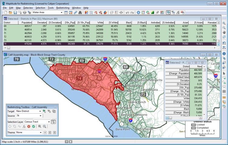
Maptitude for Redistricting, a leading software from Caliper, is widely used by governments, political organizations, and consultants to manage this complex task. The software provides tools for analyzing demographic data, visualizing district boundaries, and creating legally compliant, balanced district maps. Redistricting is critical because it directly affects political representation, voting power, and resource allocation. By utilizing advanced GIS technology like Maptitude, stakeholders can ensure that district boundaries are drawn fairly and transparently, taking into account population shifts and ensuring compliance with laws such as the Voting Rights Act.
