Mapping Software and GIS Glossary
A visability analysis is a technique for determining which locations can be seen from a specific vantage point.
Visibility analysis is commonly used in telecommunications, military applications, and landscape design. Maptitude provides tools to assess viewsheds and optimize the placement of towers, observation points, and surveillance systems. This analysis is essential for line-of-sight assessments, determining optimal placements for security cameras, evaluating scenic viewpoints in tourism planning, and ensuring that new structures do not obstruct important sightlines. Users can specify elevation, observer height, and terrain effects to refine visibility calculations, allowing for detailed and practical spatial analysis
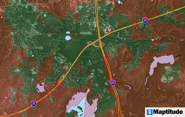
A visibility analysis of the terrain around a telecommunications tower
Maptitude Mapping Software gives you all of the tools, maps, and data you need to analyze and understand how geography affects you and your business. Maptitude includes tools for calculating the areas that you can and cannot see from a specific location.
Learn More Free Trial Free for Students/Teachers
![]()
![]()
![]()
![]()
![]()
![]()
![]()
![]()
Home | Products | Contact | Secure Store
