 By Alex Arifuzzaman MBA, Partner, Interstratics Consultants Inc.,
Instructor, Schulich MBA Retail Analytics,
Ryerson Geodemographics and Marketing Business Intelligence / Decision Modelling
Alex Arifuzzaman teaches analytics courses at the MBA Marketing Department in the Schulich School of Business and at the Ryerson University Marketing and Geography Departments. The Geography Department provides student access to several common GIS (Geographic Information Systems) platforms. The Marketing Departments do not. The Maptitude Team graciously supplies the full version of Maptitude to these students (~300 per year) at no charge. Maptitude provides access to the business analytics tools used by major corporations in the USA and globally, including Xerox and PPG Industries.
There are several types of business problems that can be best addressed using GIS or location intelligence applications. In my experience, however, it has been difficult to ask students who are often first-time users of GIS software to do any sort of meaningful analysis using most existing products on the market. Most products that I have found require extensive training to produce nice looking maps of value and/or meaningful analyses.
Maptitude makes it easy for first-time GIS users to produce meaningful and visually appealing maps and analyses. Our MBA program is using the Maptitude software to provide the location intelligence skills that students will need in today’s business environment.
In addition to ease of use, Maptitude provides the following two key benefits:
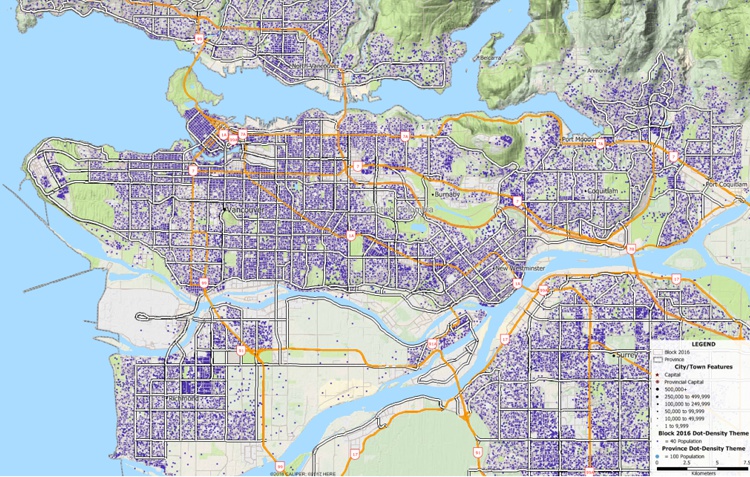
We have used Maptitude to develop many different types of reports, such as income by household maps that are simple to generate and have national coverage based on the data Maptitude provides right out-of-the-box.
A particularly useful feature that is unique to Maptitude is the "Drive Time Influence Areas" mapping. This feature is similar to a common method used for defining service areas (“Voronoi polygons”) but uses drive-time instead of straight-line distances to determine the market boundaries for each location. This calculation is orders of magnitude more complex than Voronoi calculations but is easy-to-use in Maptitude. I have not seen this capability for multiple locations in any other GIS. The trade areas that are generated are much more reflective of the real world because physical barriers and the road network are considered, better modelling how people actually travel to access services and amenities. By having students perform this type of analysis, their models have been demonstrated to be representative of true trading patterns when compared with real world data. The analysis is very useful for understanding the dynamics of a competitive network.
Another great Maptitude feature is the draping of aerial/satellite photo images (rasters) as map backgrounds. These cloud-based images can be used to add context to any map. Google Maps (or the open-source OpenStreetMaps, USGS photos, or Microsoft Virtual Earth imagery) can be enhanced with student defined geographic features much more easily than in other applications and much, much, faster even with global coverage!
Overall, the simplicity of Maptitude allows for non-GIS students to use a GIS to perform complex business analyses with only a brief (1-2 hour) training period. They will then produce maps of similar or better quality to those produced by students with weeks of training. It is for that reason that I strongly recommend Maptitude for both geography and business students alike.


The Schulich School of Business is the business school of York University in Canada. Global, innovative and diverse, the Schulich School of Business is rated among the world’s leading business schools, being the top-ranked business school in Canada by The Economist, Forbes, CNN Expansion & Corporate Knights.

Maptitude includes numerous tools for creating trade areas. Simple ring analysis tools allow you to determine the population within any chosen distance of a location. In addition, drive-time analysis tools allow you to determine the population within any chosen drive time of a location. Trade area tools also allow for different levels of detail, with Maptitude supporting both Voronoi and drive-time catchment areas around any number of origin locations.
With its focus on usability, Maptitude is an ideal solution for post-secondary education. The software includes a comprehensive help system that includes many tutorials that allow students to put GIS concepts to use in a matter of minutes.
Learn more about Maptitude to see how you and your students can use Maptitude to make more informative and insightful business decisions!
Home | Products | Contact | Secure Store