| Mapping, GIS, & Transportation Software Solutions |
| Mapping, GIS, & Transportation Software Solutions |
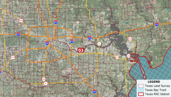
The Texas Survey System (TXSS) exists because Texas does not use the Public Land Survey System (PLSS), instead instituting a similar system that is based on Spanish land grants. The state is split into 12 railroad districts, which follow county lines. Another way of dividing the state is into townships and sections (South Texas), leagues and labors (North and East Texas), and blocks and tracts (West Texas – NOTE: NOT CENSUS BOUNDARIES), areas that, though differently named based on the region of the state, denote the same layer of geographical data.
The TXSS data contain 3 separate layers. The Texas RRC District layer contains the geographic boundaries for the 12 railroad districts. The Texas Bay Tracts layer represents a special set of 3213 survey areas that are present in bays all along the East coast of Texas. The Texas Land Survey Layer splits the state into 304,145 areas comprising tracts, sections and labors, identifiable via their code in the field abstract.
Also available is the Public Land Survey System (PLSS).

TXSS Data Map
“Over the past several years I’ve spent dozens if not hundreds of hours trying to figure this out. But the Maptitude PLSS data is wonderful because it covers most of the US and not just Oklahoma and includes Texas which is unique and covers quarter sections and below. Miraculous. I’m not sure that you Yankees understand just how useful this data is to us folks in flyover country. But it’s great. Thanks.”
Larry D. Lahman | Mitchell DeClerck | Oklahoma’s Oldest Law Firm Founded 1893
*Requires latest Maptitude or TransCAD license
Home | Products | Contact | Secure Store