This blog takes an informal look into the debates and methods related to business GIS and mapping

Author: Dr. Murray Rice

Modern businesses operate in a highly competitive environment that demands that every possible advantage is maximized, and every possible disadvantage is understood and minimized. One crucial area of competitive advantage and disadvantage relates to each business’ understanding and use of knowledge on the market area served by the business. Market understanding is important for every business, almost without exception, but it is especially important for businesses with multiple locations that serve multiple geographic markets. A comprehension of the extent and composition of each market served can function to increase the business’ penetration in each market while decreasing the business’ vulnerability to market gains by current and potential competitors.
While there is a wide range of steps that businesses can take to improve their tracking of their markets, it is important that management does not neglect even the most basic measures of market status. One foundational analysis that multi-locational (chain) businesses should use focuses on identifying the geographical extent of the trade areas served by their facilities.
One prominent application of this idea is called an "area of influence" analysis. The core idea is that this analysis identifies the extent of the market or trade area served by each member of a set of facilities. Here, this blog post covers a methodology termed broadly as an "area of influence" analysis, focused on dividing a region served by a set of facilities into multiple service areas, with each service area being served by one facility.
The applications of such an approach are broad. This analysis can focus on both public sector facilities, such as schools and DMV offices, that work together to serve the general public and have little or no competition, and private sector facilities such as retail stores and restaurants that do face active competition.
One attractive feature of influence area analysis is that completion of this analysis does not require any specific data beyond the location of the facilities being considered. Thus any business or government agency that wishes to do this analysis can do it without being limited by available data.
There are two variants of this analysis. Straight line influence analysis models the boundaries of each local zone as linear. Such an analysis is appropriate when overall insight is being sought into the nature of local trade areas, and a detailed depiction of the extent of each trade area is not important.
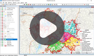
Map 1 provides an example of a straight-line area of influence analysis for QuikTrip ("QT"), a gas and convenience store chain retailer with an extensive network in Dallas-Fort Worth. This map depicts the local market area served by each of the 83 QT locations in Dallas.
This kind of representation of local markets provides a number of benefits. First, it provides the foundation for further analysis that can provide insight into the characteristics of each local market. Map 2 provides an analysis by market area that indicates which QT service areas have the highest median incomes. Map 3 provides a similar analysis indicating where median incomes are increasing at the fastest rate. Such analyses can provide insight into the best locations for targeted product introductions and facility renovations.
Second, the identification of local service areas emphasizes the locations on the map that are furthest from current facilities in the network. To see this, we need to recognize that each service area boundary (drawn in green) represents the midway point between two QT stores. Therefore locations that represent the junction of three or more service areas are particularly far away from the closest QT (see Map 4). Of course, more analysis is required to verify suitable location opportunities, but the area of influence map provides an early and simple indication of a possible need for a new store.

Map 1: Straight Line Area of Influence Analysis for QT Stores in Dallas, TX

Map 2: Straight Line Area of Influence Analysis with Median Incomes Modelled for each QT Service Area

Map 3: Straight Line Area of Influence Analysis with Median Income Growth Modelled for each QT Service Area

Map 4: Straight Line Area of Influence Analysis Highlighting Potentially Underserved Areas in Dallas, TX
While the straight-line approach is of great value in many ways, it is worthwhile to point out one problem with this method. Holes in the local street network, such as caused by the lakes and rivers, can cause the straight-line approach to provide results that deviate from reality in significant ways.
Map 5 illustrates this problem with the example of McDonald’s restaurant locations in Denton, Texas. Note how the straight-line areas of influence assign the neighborhood marked by the red oval (Lakewood Villag) to be served by location B. However, given the extent and coverage of the lake there, there is actually no road that directly connects the Lakewood Village neighborhood to location B. Instead, the McDonald’s at location A is clearly best positioned to serve Lakewood Village.

Map 5: One Problem with the Straight-line Methodology Illustrated
A second approach to area of influence identification is the drivetime area of influence analysis. This analysis is again focused on dividing a regional map into zones served by individual, local facilities. The difference here is that drivetime area of influence analysis is based on use of the local road network, rather than on an "as the crow flies" approach. The second analytical type produces service zones that are more complex in shape but are closer in form to reality than those created by a straight-line analytical approach. Again, no detailed customer business data is necessary to generated drivetime area of influence map except for the location of facilities in the area depicted.
Map 6 provides an example that illustrates the utility of the drivetime approach. As with its straight-line counterpart, the drivetime analysis identifies the extent of local service areas that are uniquely best (or most closely) served by a given location. The map reflects a more detailed view that comes closer to reality than the straight-line representation.

Map 6: Drivetime Area of Influence Analysis of McDonald’s Locations in Denton, Texas
What about the problem with the straight-line approach we just mentioned? Map 7 shows how this issue is fixed by not taking an "as the crow flies" approach. The drivetime analysis assigns the Lakewood Village neighborhood to location A rather than location B. Drivetime analysis fixes this kind of problem automatically through how it works.

Map 7: The Lakeshore Problem Solved
Map 8 provides one more combined view of the two area of influence methods. It shows that despite the differences in their two respective approaches, the two methods provide similar results (see the neighborhoods represented in the lower middle of the map area). Differences emerge between the two where the local road network becomes more sparse (such as with the green zone represented in the left part of the map area).

Map 8: Results from the Two Approaches Compared


Home | Products | Contact | Secure Store
