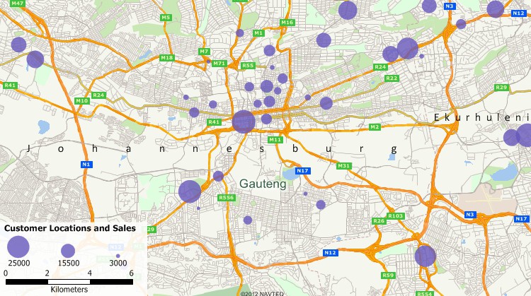
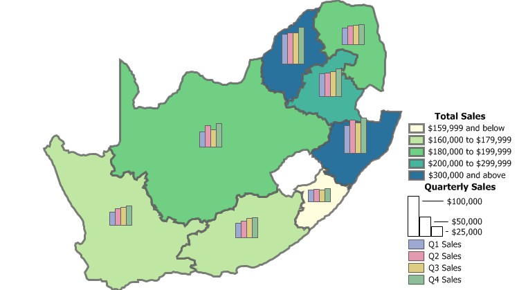
Maptitude provides ways for you to use maps to analyse and understand how geography affects you and your business. Maptitude is a powerful combination of mapping software and geographic data that provides everything that you need to make informed decisions and get the maximum return on your sales and marketing budget. Maptitude includes easy-to-use analysis tools that will allow you to unearth the trends and information hidden in your data.
(Click here to see a short demo of mapping and analysing your data with Maptitude)
Maptitude is designed to make mapping sales data easy. With Maptitude you can:
Locate Your Customers:
Pin map the locations of your customers so that you can better serve them and better reach them with your sales message.
- Find where your customers or prospects live and identify how well they are served by your existing infrastructure
- Determine where to purchase billboard space, which community newspapers to advertise in, and in which radio markets to purchase time, to best reach your customers
- Map sales data for your aggregate customers by municipality, district, province, or sales territory.
Build Sales Territories:
Create sales territories out of municipalities, districts, provinces, or any other type of area. Calculate the demographic characteristics of your custom territories and attach your own data to them. For more information, see the Sales Territory Mapping page.
Use Your Own Data:
Maptitude lets you create maps using your own data. Maptitude has direct access for a number of database, geographic, and raster file formats. In addition, you can access your data via ODBC from a number of data sources such as Access, Oracle, or SQL Server. You can also join and aggregate your data to any of the nationwide geographic files included with Maptitude such as postcodes, localities, and states, or to your own custom territories.
| Sales Mapping Software Highlights |
|---|
|

The South Africa data package includes streets for the entire country with address and postal code ranges that you can use to locate your facilities and customers.

Maptitude customer mapping software makes mapping sales and building sales territories easy.