Maptitude includes a vast amount of business-critical data at no additional cost, such as demographics, boundaries, streets, and the most accurate ZIP Code/postal boundaries available.
There is an amazing amount of useful data included with Maptitude Mapping Software. Maptitude includes a FREE Country Package with a tremendous amount of nationwide geographic, Census, and demographic information so that you can get started as soon as you access the application.
In addition, there is an extensive catalog of business and demographic data that lets you analyze and find the best opportunities for your organization. Maptitude demographic and business data are available in a number of formats including table formats for use in spreadsheets/databases and geographic layers for use in GIS and mapping software.
 Nationwide mapping out of the box!
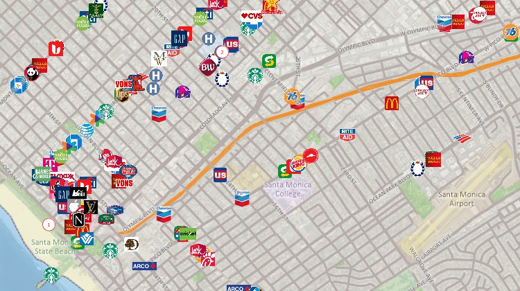
Maptitude includes millions of POI records with information on location, category and brand, lat/long, address, phone number, and more. See why Maptitude is such a popular data source for locations all around the world.
The database includes point layers for 85 categories of location in the USA, 84 categories in Canada, and 89 categories in the United Kingdom. Categories include shopping malls, banks, restaurants, clothing stores, auto dealerships, grocery stores, pharmacies, and hospitals, and include points with company logos for automotive, bank, cellular phone, convenience store, gas/petrol, grocery, hotel, pharmacy, restaurant, and retail chains.
The locations of businesses and points of interest are available for Canada, the United Kingdom, Australia, DACH (Germany, Austria, and Switzerland), and the United States. These layers are perfect for site location, competitive analysis, routing, and real estate reports. The layers have attractive icons and can be added to any Maptitude map.

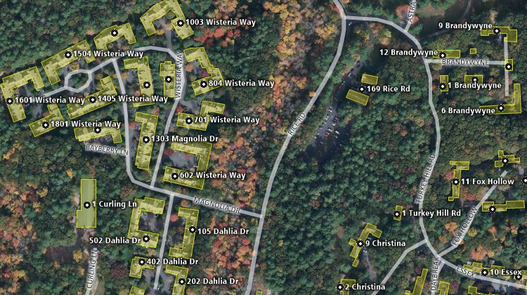
The Maptitude Address Points and Building Footprint datasets support more accurate geocoding and site location analysis. The USA Address Points contains 48,644,837 addresses that cover 22 states and the District of Columbia, and are perfect for direct mail campaigns, door-to-door canvassing, school districting, rooftop accuracy visualizations, assisting with deliveries, and any other application for which more precise address data are required. The building footprints are available for the USA (over 124 million buildings), Canada (over 12 million buildings), or Australia (over 11 million buildings).

Maptitude SafeGraph alternative map of address points and building footprints
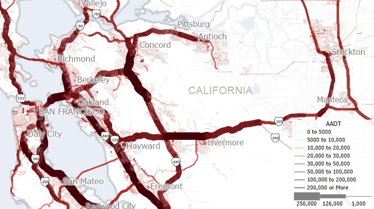
Aggregate traffic data to specific roads or to any geography such as Census Block Groups (CBGs). Maptitude traffic data helps you see trends of what locations or neighborhoods are getting traffic.
Maptitude allows you to analyze Total Annual Average Daily Traffic (AADT), semi-trailer daily traffic, single-unit truck and bus daily traffic, number of through lanes, and road classification. Annual average daily traffic is the total volume of vehicle traffic on a highway or road for a year divided by 365 days. AADT is a useful and simple measurement of how busy a road is and is useful for:

To learn about data availability in your GIS file format of choice (e.g., shapefile, KML, KMZ, GeoJSON), please contact a Maptitude data expert today by emailing sales@caliper.com or by calling us at +1 617-527-4700.
 How Digital Finance Analytics Assesses Financial Stress with Maptitude |
 |
“Maptitude is an incredibly powerful program for a very competitive price. The integration of census data and the ease of using your own data make an incredibly useful program. They are continually adding new and free data points to the included data. If you need to visualize data on a map this is the program to get.”
|
 |
“The data is accurate and visually appealing. What this will mean in understanding the world around me is enormous. I have been able to jump right in and make beautiful, meaningful and accurate maps. Having the power to analytically divide markets, populations, etcetera, will result in decisions with pinpoint accuracy.”
|
Home | Products | Contact | Secure Store