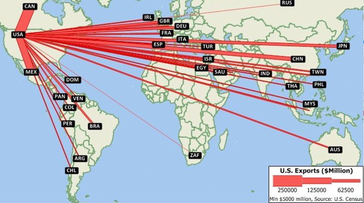
Maptitude optimization mapping software include tools for solving all types of network optimization applications such as:
Other tools included with Maptitude logistics software have broad applications in transportation and marketing. Clustering routines assemble customers, facilities, or areas into groups that are compact and can be serviced efficiently. Districting models group Census areas, ZIP Codes, counties, or other regions into territories that are compact and balanced. Location models evaluate the costs and benefits of any number of proposed facility locations. These models can be used for:
Please contact sales@caliper.com for more information on our logistics mapping software.
|
|

Maptitude Supply Chain Guru alternative for logistics mapping

Facility location tools in Maptitude Supply Chain Guru replacement

Maptitude vehicle routing tools
 |
“Maptitude adds features and enhanced capabilities, that make it a continued pleasure to work with. Even after years of use I come across new options that allow for quality analysis. Frequently now, I apply the facility location tool, which offers outstanding opportunities to relocate warehouses or stores. Used creatively, for instance in Service Logistics engineer allocation projects, finding the right location for a pudo or dropbox location is a breeze with this tool. Multiple scenarios can be calculated and analysed, and the results integrated in Excel- or Power BI models. Maptitude continues to deliver complemented with outstanding support and training.”
|
 |
“Maptitude is excellent for doing geographic analysis projects looking at: where existing customers are and new ones might be (including using the built-in demographic data); identifying hot-spots, patterns and trends that can't be seen in Excel. It is really helpful with network design tasks - which sites are best: centers of gravity; visualizing size of flows between distribution centers; allocating volume to different depots.”
|

 Check out our G2 Reviews
Home | Products | Contact | Secure Store