Maptitude is a powerful tool for emergency management. It includes detailed demographics describing the locations of businesses, households, residents, and employees, which are critical for evacuation plans. In combination with the latest demographics, the routing and drive-time ring analyses provide a clear picture of accessible areas and can be overlaid with data such as the latest weather patterns via the imagery tools.
For example, Maptitude Country Packages include comprehensive locations for hospitals, emergency rooms, police stations, military bases, and more. These data provide a complete framework for exploring emergency service scenarios.
Maptitude can be also be used to define territories such as fire department service districts.
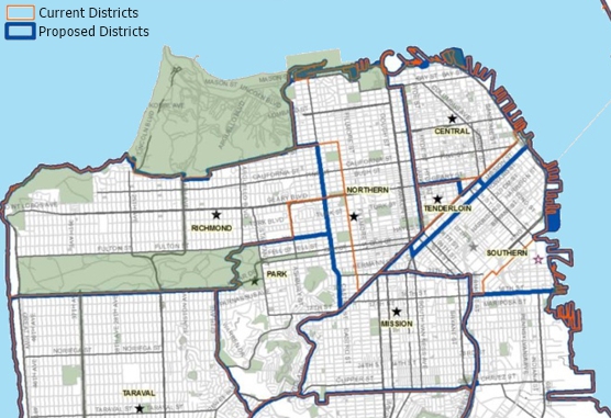
How Public Safety Strategies Group Used Maptitude to Create New Police Districts. More...

Divide the streets in a city so that each is assigned to the nearest hospital or fire station
Create districts balanced by population, incidents, and other variables
 |
“For special projects and reports, Maptitude provides better analysis and illustration of information. Using tabulated data, this program creates maps, charts, and graphs. For example, the extreme damage caused by Hurricane Ivan in September 2004 required immediate emergency response from the AFC.”
|
Every community, whether large or small, needs to be able to respond to a disaster quickly. The primary use of GIS in responding to disaster is performing the damage assessment after the event has occurred. Completion of the damage assessment is a prerequisite of the release of federal relief funds.
When an F4 tornado struck the City of Clarksville, Tennessee, it did severe damage to the historic downtown area, to Austin Peay State University, and to local homes and business. Using Maptitude, the Clarksville/Montgomery County GIS Center, in coordination with the Planning Commission, conducted a damage assessment which was completed within thirty-six hours of the tornado’s touchdown. The street map layer incorporated with Maptitude was used to locate over six hundred damaged or destroyed structures by address from information from a field survey. More...
Emergency management consultants, such as Emergency Management Group, rely on Maptitude to develop comprehensive Fire Master Plans for municipalities. By analyzing department data—from call volume and response times to population density—Maptitude identifies coverage gaps, optimizes station locations, and helps forecast future staffing and resource needs. An example of this work can be seen in the Niagara-on-the-Lake Fire Master Plan, where advanced mapping and geospatial analysis with Maptitude provided the foundation for strategic recommendations. Fire departments can use Maptitude to visualize their communities, streamline decision-making, and ensure that all residents receive the highest level of fire protection and emergency response.
To see more fire master plans please visit Maptitude Article Library.
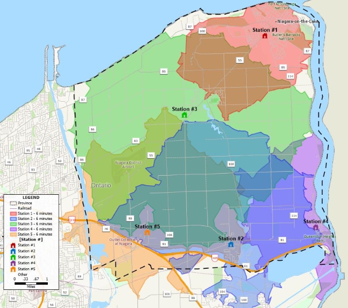
6-minute response zones for fire stations
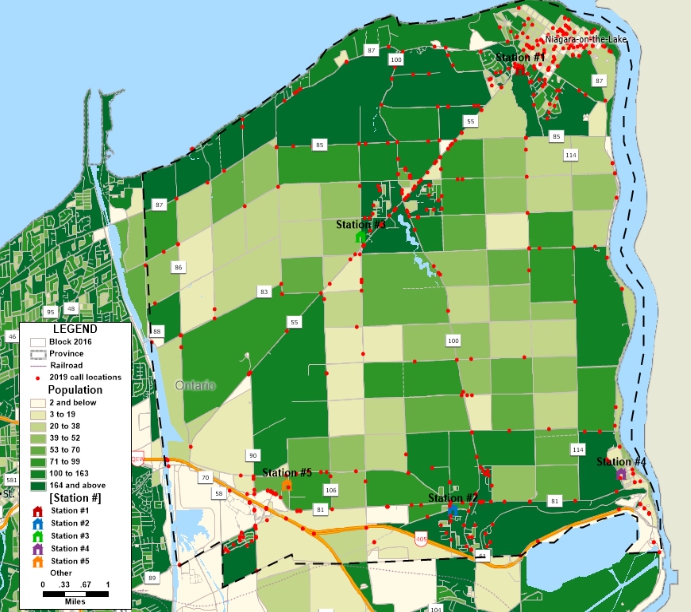
Call locations and fire stations
 |
“The the new features in the Maptitude program make my job easier! Thanks!! Favorite aspect of this product? Ease of use as well as being able to find out specific info within my drive rings. This is a great product that I have had to learn to use, with no training which has been fairly easy.”
|
There is no limit to the number of point styles that can be applied in Maptitude. You can use any of your own images, plus the software includes hundreds of icons that can differentiate customers, locations, and competitors.
Maptitude includes the United Nations Office for the Coordination of Humanitarian affairs (OCHA) icons to help relief workers present emergency and crisis-related information quickly and simply. The set of symbols covers complex humanitarian issues such as access to people in need and protection of civilians, plus those for natural disasters and relief supplies.
Travel time is the most realistic way of describing market areas and access to services. Emergency services may want to map their response time coverage for an area. The drive-time rings tool in Maptitude supports these types of analysis based on the creation of realistic catchment areas, and with a single click can create detailed demographic reports (see video here).

 Check out our G2 Reviews
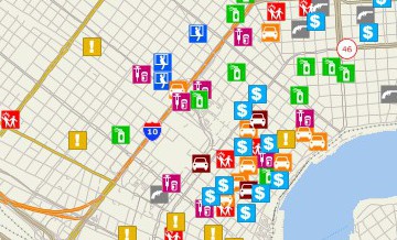


Home | Products | Contact | Secure Store

