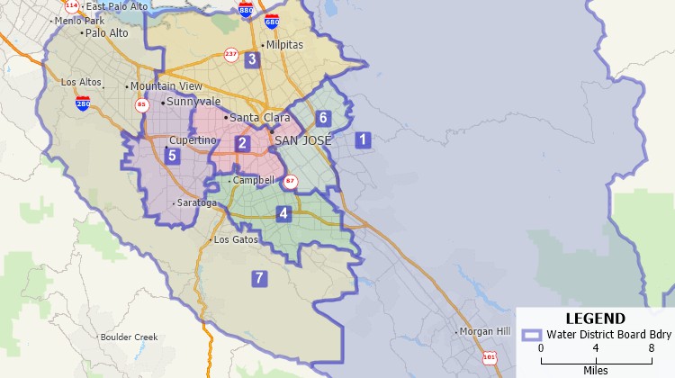
A Water District, administered by a board of directors, is a political subdivision of the State. They are sometimes known as Municipal Utility Districts (MUDs). One of the most significant aspects of water districts is that they are governed by a board of directors chosen by the district's residents through elections. It is the responsibility of this board to perform all the district's business, including resource management and 3rd party contracts. Water districts can often:

Maptitude water board redistricting software for creating and updating water districts
Maptitude for Redistricting makes it easy to update water district boundaries. A web-based version, Maptitude Online Redistricting, is suitable for individual citizens, board members, and legislators who wish to propose boundaries for their water district or even an entire plan. There is also a version that runs as an extension to ArcGIS if you prefer working in that GIS environment.
Maptitude is the perfect solution for adding additional GIS users where Esri software is already in use. Maptitude:
To learn more about Maptitude for Redistricting, please see the Features page. For more information on the City/County Edition, contact Caliper Sales at sales@caliper.com or by phone at 617-527-4700.

|
“It's light years ahead. The software can do so much more, so much more quickly.” Karl Aro |
 |
 |