

Author:
Stewart Berry
Images: Dan Martin
13 February 2025
Creating real territories, with defined boundaries, is fundamental and crucial for many industries and for organizations of all sizes. Finding an application that allows you to create the territories that you want and in a straightforward way is harder than you would think. Especially if you want to do this on a budget as a startup, or if your alignment requires the territories to have equal characteristics such as sales or population.

Creating territories is usually driven by two key factors: necessity and/or fairness.
Franchises may need to create legal definitions of the territory for each franchisee, based on metrics that prevent cannibalization between identical outlets, while providing a sustainable market area. Franchises are also concerned with negative sales impact and encroachment, so being able to update the underlying geography, demographics and sales information is crucial for real world, non-static, territory analysis. Areas (such as ZIP Codes) must be able to be moved into and out of territories, with the impact on sales and target population tracked as you make changes.
For sales representatives, having a defined sales territory prevents cannibalization, and when done right, offers fair opportunities for each rep. In addition, territory specific marketing can be conducted and optimized by territory, such as mailing campaigns, bill boards, and promotions. It is important to prevent sales reps from competing against one another for the same prospect because this results in wasted time, resources, and fuel on routes that while optimized per sales rep, are not optimized by sales team.
Indeed, when conducting market research, competitor analysis, and territory/franchise alignments, it is critical to understand the geographic context of your service area. Working within an echo chamber of your own sales team, without consideration of their geographic overlap, let alone overlap from competitors, is a risky approach.
When choosing a software application for territory management you should, in most cases, ensure that the product offers tools for both optimized routes and territory boundary creation. Integrated maps that support the use of these tools out-of-the-box is another big consideration because of the time and money savings provided by this ready-to-use data. Being able to create territories based on a table or Excel spreadsheet is also a common and critical feature.
There are surprisingly few applications that meet the above criteria of an effective business mapping tool that supports the business needs of the user without requiring extensive learning or investment. MapPoint is one such tool but the sale of MapPoint will be completely discontinued at the end of 2016. Another such product is the popular and widely used Maptitude.
In the following sections we discuss the various methods for territory creation.
Often a territory is an area that is made up of several smaller areas “merged” together. For example, sales territories or market areas might be made up of groups of postal zones, counties, or other regions:
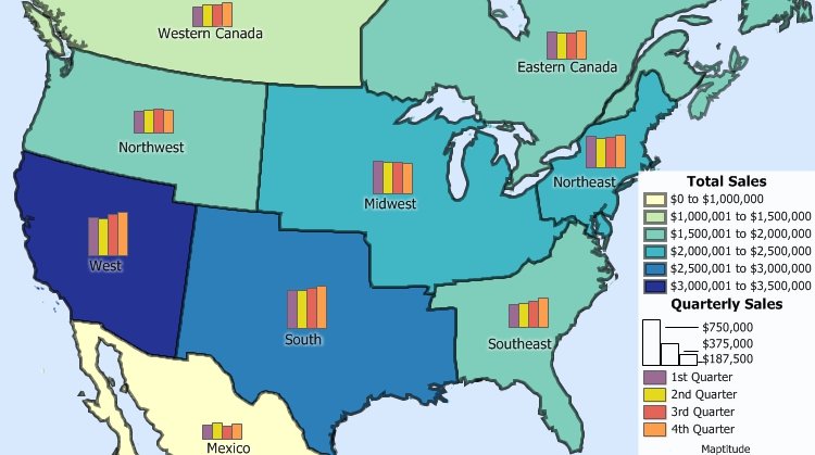
Maptitude sales territory map software can map territories from smaller areas, such as states and provinces, with your data attached.
There are two key ways that people want to create territories:
It is also common for territories to overlap or for territories to be defined by streets.
To support point-and-click territory creation the software should have:
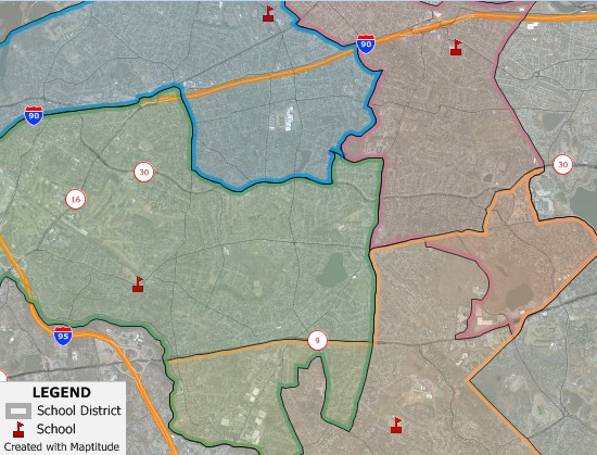 A wizard that walks you through importing your region,
county, or postal data directly into a new territory map. This
tool should be able create your territories based on whatever
data filters and queries you require. Further, the territories
you create should be able to overlap in as many places as
required with maps that allow you to easily distinguish
overlaps.
A wizard that walks you through importing your region,
county, or postal data directly into a new territory map. This
tool should be able create your territories based on whatever
data filters and queries you require. Further, the territories
you create should be able to overlap in as many places as
required with maps that allow you to easily distinguish
overlaps.There are two common ways that territories are automatically created:
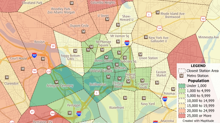
There are also tools that automatically "balance" territories so that they are the same size or so that they contain equal numbers of customers, sales, population, or any other value.
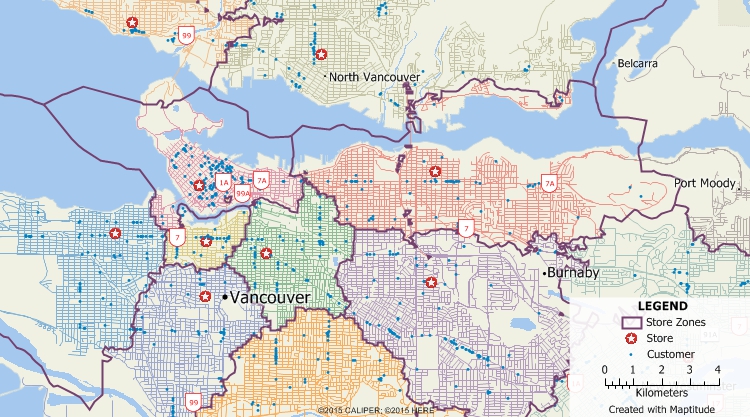
Maptitude is one of the few applications that has the variety of routing and territory tools that meet the varied needs of a startup, at a price that doesn’t break the bank, while being considered easy-to-use by its broad customer base.
Unlike many other mapping and GIS software packages that require users to purchase data separately, Maptitude is a professional territory map creator that includes extensive geographic and demographic data so that you can immediately start creating territories.
Create your own custom territory maps like these balanced, 5-million population territories based on ZIP Codes! Try the full-featured version of Maptitude with a 1-month risk-free trial.
For more information on Maptitude GIS please visit www.MappingSoftware.com.
Learn more about Maptitude to see how you and your team can use Maptitude for territory alignment!
Schedule a Free Personalized Demo

Home | Products | Contact | Secure Store