Since 1995 the Maptitude mapping software has made it easy to access a wealth of US Census data for the entire country. You can quickly visualize Census demographics using a suite of wizard-driven tools. Maptitude also provides a map library that contains numerous pre-designed maps listed by Census category. These include thematic maps of demographic, income, and housing data. The Map Librarian lets you open one or more of these maps for a chosen location, allowing you to quickly analyze U.S. Census data for your area of interest.
The Census is the only comprehensive and truly reliable source for nationwide demographics. Maptitude contains 2020 Census variables that describe population, age, race, gender, ethnicity, and housing, as well as the latest American Community Survey (ACS) data for income, occupation, education, language spoken, marital status, travel mode and time, housing value, housing costs, and more.
| Census Software Highlights |
|---|
|


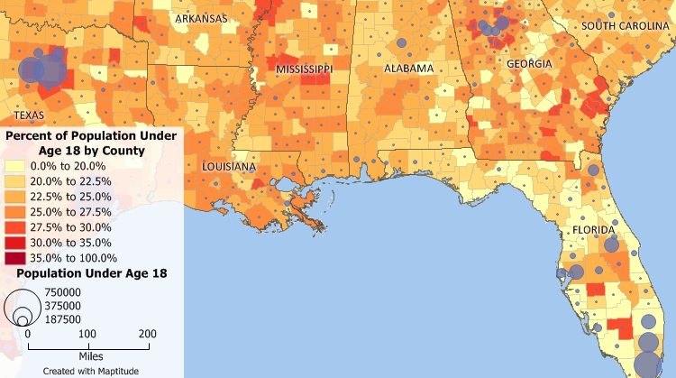
Create color, heat, dot, chart, and symbol maps illustrating Census demographic data such as this map that shows the number of people under age 18 and the percent of the population under age 18 by county based on the Census ACS data.

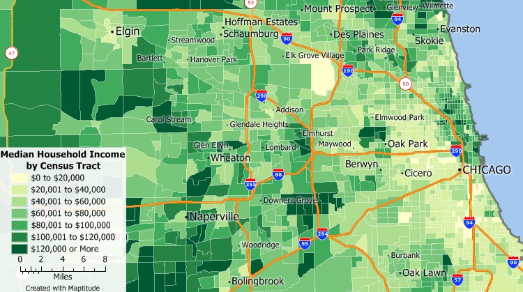
Maptitude includes Census and American Community Survey data down to the tract level in the United States.
 |
“The Maptitude demographics provide significant added value not available from other sources, revealing new information such as how many adolescents are likely to use a health program.”
|
 |
“Maptitude is an excellent GIS program and is priced very low considering the value it provides. It has tons of geographic and demographic information; it's relatively easy for beginners; there are tons of online guides, training materials, and seminars; tech support is very responsive and helpful. I highly recommend this program to anyone looking for basic to complex functionality in a GIS program.”
|

Caliper Corporation leads the industry in the processing and release of Census data. The Maptitude United States Country Package includes Census and ACS data for many boundaries including Census Block Groups, Census Tracts, Counties, County Subdivisions (MCDs and CCDs), Metropolitan Statistical Areas (MSAs), and States. In addition Blocks can be purchased separately for use with Maptitude.
The Census is taken every 10 years and the latest version of Maptitude includes demographics from both the 2020 and 2010 Census. In addition, American Community Survey (ACS) 5-year data are an average over a 5-year period that are updated each year and included in the latest version of the United States Country Package.
»Learn more about what Census data are included in other Maptitude Country Packages.

 Check out our G2 Reviews
Home | Products | Contact | Secure Store