Maptitude is an alternative to Hexagon Geospatial's (an Intergraph Corporation division) GeoMedia Professional geographic information system (GIS).
Maptitude can create maps with straight-forward and familiar Office style file management and supports one of the most comprehensive native file format libraries available. Maptitude has a suite of geographic analysis tools and enforces layer topology allowing for robust spatial editing of point, line, and area features. Maptitude is used for producing, editing, and managing geographic data, combining geographic and business data with location intelligence, making hard-copy and digital maps, and analyzing information within the intuitive medium of the map.
Maptitude is a single integrated application without the need for costly add-ons, and is used widely in sectors ranging from military, government, utilities, healthcare, franchising, communications, logistics and transportation, retail, real estate, banking, consulting, and many more.
Maptitude is used at small businesses up to Fortune 500 enterprises, providing an organization with the ability to perform sophisticated spatial analysis and to share results with stakeholders and team members both locally and over the web via Maptitude Online.
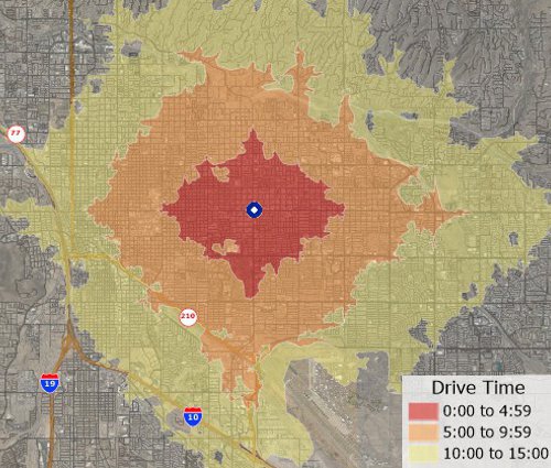
Maptitude analysis tools replacement for Intergraph GeoMedia
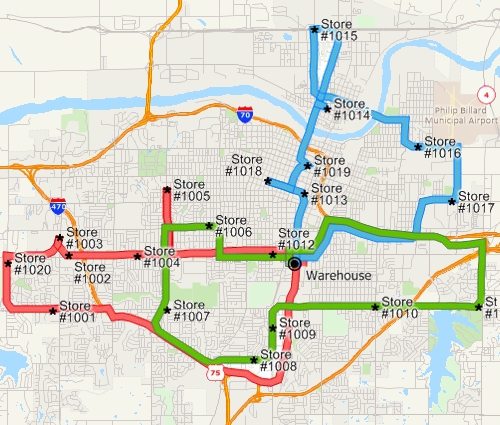
Maptitude Routing and Deliveries Manager alternative to GeoMedia
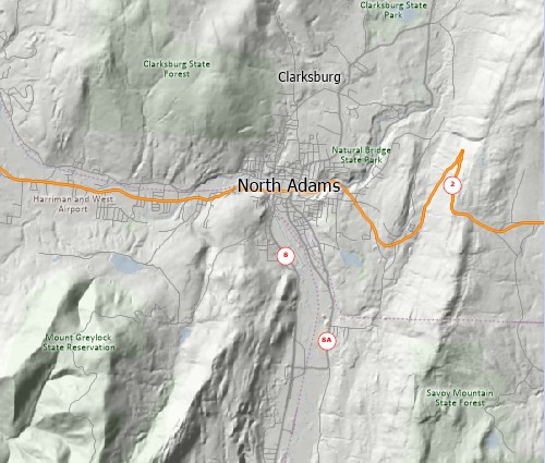
Maptitude contour map Hexagon GeoMedia alternative
| MAPTITUDE (Annual) |
GeoMedia Essential |
GeoMedia Advantage |
GeoMedia Professional Plus |
GeoMedia Transportation Manager Plus |
GeoMedia Mapping Manager |
|---|---|---|---|---|---|
| $695-1295 | $2,779.47 | $5,558.24 | $11,580.18 | $7,411.68 | $4,632.21 |
 |
“If Maptitude isn't the program of choice for those wanting to develop mapping applications, it does represent the strongest combination of value, ease of use and power in an out-of-the-box solution. It earned a final score of 7.10.... If you're prepared to develop your own GIS application, GeoMedia - finishing with a final score of 5.80 - offers a strong platform with solid data connectivity and format support. Just don't expect an out-of-the-box solution that will have end users generating attractive maps in short order.”
|
 |
“Maptitude has been an important tool for showing the geography of a variety of facilities and parameters, from rig trends by state, to patent trends by metro area, to the location of important infrastructure installations. Being able to illustrate and map these elements with Maptitude was essential for the analysis and, in addition, the software is backed up with outstanding support if needed.”
|
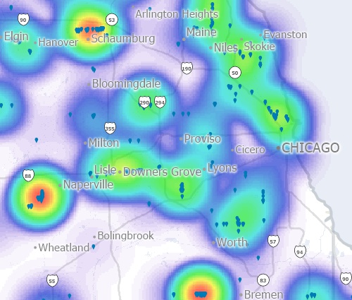
Maptitude heat map alternative to Intergraph
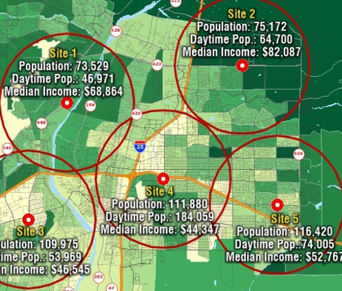
Demographic overlay results created with Maptitude Geomedia alternative

Detailed business map created with Maptitude Intergraph alternative


Maptitude |
The best mapping software and GeoMedia replacement! Here's why:√ Maptitude is the easiest-to-use full featured mapping software, and includes powerful tools such as multi-ring drive-time zones √ Maptitude has no subscription fees, and supports secure off-line data storage
√ Maptitude provides fully customizable maps with unlimited point icons √ Maptitude has unlimited pin-mapping/geocoding √ Maptitude includes free mapping data and demographics covering everything from population statistics to business locations, postal/ZIP Codes, and more! |
Home | Products | Contact | Secure Store