Maptitude is feature equivalent to MapPoint and supports MapPoint files.
Maptitude dominates the space vacated by the discontinued Microsoft MapPoint. Maptitude can open territory, waypoint, and pushpin layers from Microsoft MapPoint PTM files. Maptitude also supports Microsoft Streets & Trips EST files and AutoRoute AXE files. Maptitude even imports the pushpin icon styles and colors.
You can see the benefits that Maptitude will bring to your organization through our many videos and webinars, which will also make you as productive as possible with the software. For example, you can register to attend the webinar Using MapPoint Data in Maptitude and can view the webinar handout here. Below are several tips-and-tricks for working with MapPoint PTM files in Maptitude:
Demo/Contact Learn more MapPoint Developers

|
“I was in a bind when MS retired MapPoint. I discovered Maptitude in 2009 and have been using the software since then. Once you take time to use the various features, it becomes a joy to use when evaluating different market conditions/situations. I do enjoy using this software.”
|

|
“I was looking for a replacement to MapPoint, I found it, and it is many times better that the defunct MapPoint. The customer service is great too at Maptitude.”
|
 |
“Ease of moving territories, obtaining census data, and plotting territories to that data. Beautiful interface and several ways to customize the product and exports. The ability to pull in my older MapPoint files and data was a huge plus!”
|
MapPoint users can migrate their data to Maptitude via a simple File-Open. The ability to easily access MapPoint pushpins and territories will be valuable to users that have invested in MapPoint, but who now need to move to Maptitude following the discontinuation of the Microsoft product.

Maptitude mapping software is the best MapPoint PTM file viewer
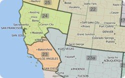
Maptitude makes it even easier to create territories from your MapPoint files.
Territory creation was one of the best features of Microsoft MapPoint and has been improved in Maptitude! Not only can you import territories that have no data fields, but you can also create territories with State and County information in separate fields, which was the MapPoint default.
Once you have chosen to open a MapPoint PTM file, Maptitude automatically walks you through the simple steps to create your territories. A territory layer is created that can immediately be used to create Excel reports with a demographic breakdown sheet, plus sheets for any other data that you have mapped and that fall within your territories.

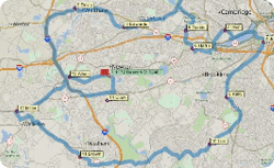
The Maptitude Routing Manager makes it easy to create and manage your routes. The ability to control the characteristics of the route and each waypoint, such as itinerary and driving speeds, is a critical step in the planning of your routes. This was one of the best features of Microsoft MapPoint and is part of Maptitude!
You can now import route waypoints from MapPoint, Streets & Trips, and AutoRoute. Simply choose File-Open, choose your Microsoft file type, and Maptitude adds them as a new point layer. By clicking the Add Locations button in the Routing Manager, you can then load the waypoints along with the stop order, names, and stop time.

Import MapPoint Routes Waypoints to Maptitude
The Maptitude Routing Manager make it easy to create and manage your routes. Being able to control the characteristics of the route and each waypoint, such as itinerary and driving speeds, is a critical step in the planning of your routes. This was one of the best features of Microsoft MapPoint and is included with Maptitude!

The Maptitude territory tools make it easy to create and manage your territories. Being able to access and share your territory definitions, such as postal/ZIP Codes by territory, is a critical step in the definition of your boundaries. This was one of the best features of Microsoft MapPoint and is included in Maptitude!

Export list of territories from Maptitude to Excel
Home | Products | Contact | Secure Store