If you need a custom map for your story, blog, or website, contact us because we offer a limited number of free custom maps on a first-come, first-served basis! See our Featured Maps for inspiration.
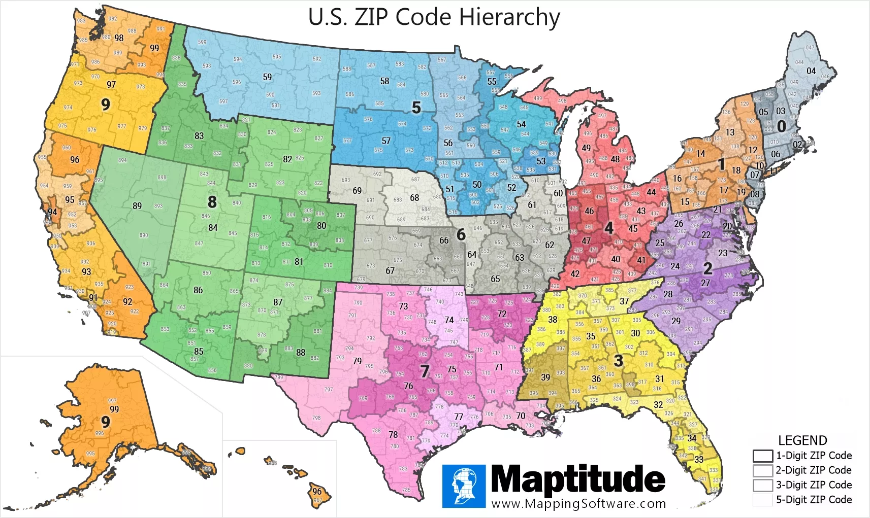
Maptitude is the best mapping software for business intelligence! Maptitude mapping software provides complete support for hierarchical sales territories with any number of levels in the hierarchy. The interactive and static maps below illustrate the hierarchical relationship of U.S. ZIP Codes. The first digit identifies one of ten large areas from 0 in the Northeast to 9 in the West. The first two digits of a 5-digit ZIP Code indicate a State or a geographic portion of a heavily populated State. 3-digit ZIP Codes are a collection of 5-digit ZIP Codes with the same first three digits and identify a major area withing a State.

Map: Created with Maptitude Mapping Software by Caliper, April 2024
#Maptitude #Territory #Hierarchy #ZIPCode

Home | Products | Contact | Secure Store