Mapping Software and GIS Glossary
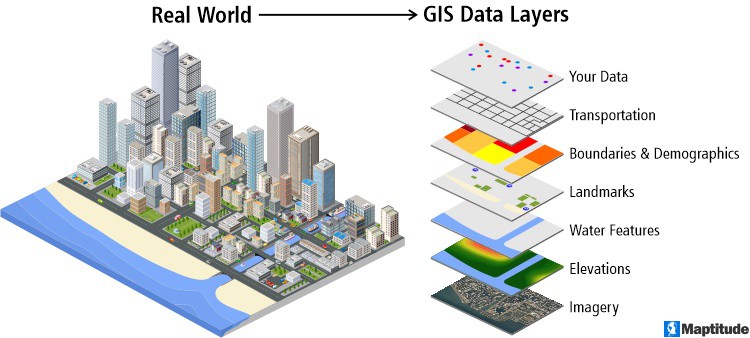
A map layer is a GIS database containing groups of point, line, or area (polygon) features representing a particular class or type of real-world entities such as customers, streets, or postal codes. Layers can also be of raster images such as those taken by satellites. A layer contains both the visual representation of each feature and a link from the feature to its database attributes. Maps in a Geographic Information System are made by combining multiple layers.

A GIS map combines layers of data representing real world locations and entities
Maptitude Mapping Software gives you all of the tools, map layers, and data you need to analyze and understand how geography affects you and your business.
Learn More Free Trial Free for Students/Teachers
Home | Products | Contact | Secure Store