Mapping Software and GIS Glossary
Proximity analysis involves evaluating the spatial relationships and distances between features within a geographic dataset. It includes operations such as nearest neighbor analysis, buffer analysis, and spatial clustering to assess spatial patterns and interactions.
Some types of proximity analysis include:
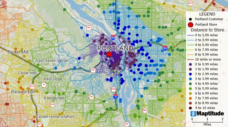
A proximity analysis of a store with streets and customers distance to the store calculated and illustrated with color themes.
Maptitude Mapping Software gives you all of the tools, maps, and data you need to analyze and understand how geography affects you and your business. Maptitude lets you perform all sorts of proximity analysis including buffers, drive-time rings, spatial autocorrelation, drive-time tables, market share, drive-time territories, areas of influence, filtering by adjacency, and clustering.
Learn More Free Trial Free for Students/Teachers
![]()
![]()
![]()
![]()
![]()
![]()
![]()
![]()
Home | Products | Contact | Secure Store
