Alternative to Visum
There are many benefits when you use TransCAD as an alternative to Visum for transportation planning:
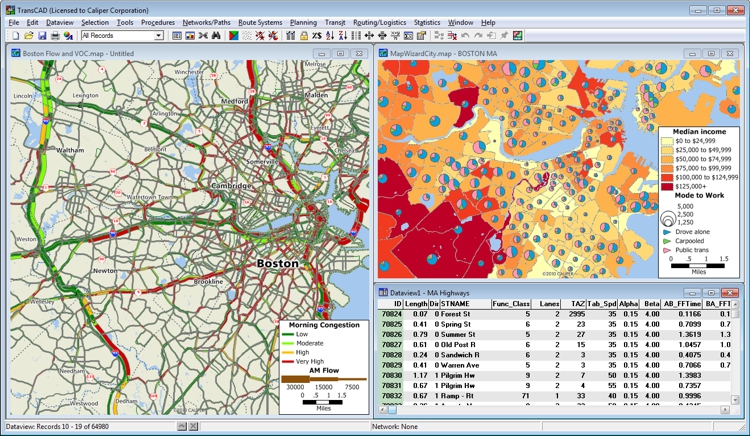
- TransCAD contains a powerful GIS engine with special extensions for transportation and special mapping, visualization, and analysis tools designed for transportation applications
- TransCAD includes application modules for routing, travel demand forecasting, public transit, logistics, site location, and territory management
- You can acquire and install TransCAD at a much lower cost than any other integrated GIS and transportation modeling solution
- You don’t have to build custom applications or complicated data interchange modules to perform transportation analysis with GIS data
- Model application, model estimation, database support, GIS, and analytical postprocessing are all unified in TransCAD so there is no need to master multiple programs nor waste time inporting and exporting files.
- TransCAD provides high quality map output with dozens of thematic mapping styles, unlimited colors, scalable line styles and symbols, and built-in highway shields.
- TransCAD has the most comprehensive set of transportation modeling procedures and performs integrated modeling of all modes of transportation including car, HOV, truck, bus, rail, bicycle, and pedestrian movements.
- Many of the key TransCAD procedures are multi-threaded, resulting in enourmous speed improvements on today's multi-core processors.
- TransCAD contains a powerful matrix engine and virtually unlimited modeling capacity. There are no hard limits on the number of zones or the size of the networks to be modeled.
The best traffic analysis and forecasting software! Here's why:
- TransCAD is the first and only Geographic Information System (GIS) designed specifically for use by transportation professionals to store, display, manage, and analyze transportation data.
- TransCAD combines GIS and transportation modeling capabilities in a single integrated platform, providing capabilities that are unmatched by any other package.
- TransCAD can be used for all modes of transportation, at any scale or level of detail.

“Although aimed at transportation TransCAD excels as a GIS. So powerful is its data structure that one can use matrix operations in the industry standard matrix model. None of the GIS software are capable of matrix modeling --- the foundation of mathematical modeling where vectors are involved.”
Rudy Banerjee |
